Google maps works fine, it shows route and some distance you should go by foot:

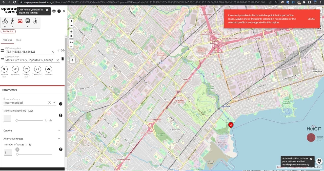
On openrouteservice it just can’t find route:
Is there any way to make it working like on google maps? Any parameter i should add in API call?
Google maps works fine, it shows route and some distance you should go by foot:
Hey,
there is a barrier=gate-tag on the road that gmaps is taking.
This prevents the car profile from taking it, since the default for gates is to be non-passable. See this post for more info.
Best regards