Hi, I have questions regarding extra_info, especially waytype values. In the github document(https://github.com/GIScience/openrouteservice-docs#waytype), the waytype category seems to be in the range of 0~10.
However, if i apply this to my code, i get values which does not belong to the categories provided in the github like 83,87,115 and etc.
Would you be able to tell me what those number exactly mean?
Thank you.
Hi @capstone
could you please provide an example request that gives you a response with the mentioned values ?
Best regards.
I wrote the code in python.
request = {“coordinates”: [[data[i][0],data[i][1]],[remaining[j][0],remaining[j][1]]],
“preference”: “fastest”,
“extra_info”: [
“waycategory”,
“waytype”],
“profile” : ‘driving-car’
}
routing_req = clnt.directions(**request)
time_list.append((routing_req[‘routes’][0][‘summary’][‘duration’]))
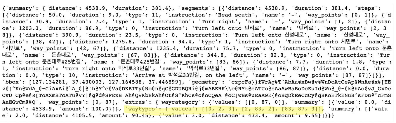
I’m curious about what I marked with the highlighter.
hmm normally this should be documented in the responses tab of the interactive documentation. I will have to fix that.
this i the documentation for the values array of any requested extra information:
A list of values representing a section of the route. The individual values are: Value 1: Indice of the staring point of the geometry for this section, Value 2: Indice of the end point of the geoemetry for this sections, Value 3: [Value](https://github.com/GIScience/openrouteservice-docs#routing-response) assigned to this section.
So these represent segments of the route that have the value you can derive from the tables at the ors-docs readme.
waytypes: {'values':[[startPointFirstSegment, endPointFirstSegment, waytype value],[startPointSecondSegment ...
You will have to decode the geometry to extract the exact points or use the geojson endpoint.
best regards
Thank you for answer.
If I have any questions, I will ask you again.