Hi there,
thanks for your hint.
take a look to my code (Angular):
const apiUrl = 'https://api.openrouteservice.org/optimization';

  let jobsBody = [];
  let vehiclesBody = [];
  for (let i = 0; i < 6; i++) {
    const jobsLocations = [
      [12.0202443, 42.039349],
      [14.5911201, 40.8209326],
      [12.5902917, 43.0957988],
      [12.5454813, 42.89363],
      [12.6587053, 42.9745784],
      [12.7339929, 43.3330812]
    ]

    const vehiclesLocations = [12.8059101, 43.4353756]

    jobsBody = [...jobsBody, {
      id: i,
      service: 300,
      location: jobsLocations[i],
      skills: [1],
      time_windows: [[32400, 36000]]
    }]

    if (i < 2) {
      vehiclesBody = [...vehiclesBody, {
        id: i,
        profile: 'driving-car',
        start: vehiclesLocations,
        end: vehiclesLocations,
        capacity: [4],
        skills: [1, 14],
        time_window: [28800, 43200]
      }]
    }

  }

  const body = {
    jobs: jobsBody,
    vehicles: vehiclesBody,
    options: {
      g:
        true
    }
  }

  this.http.post<any>(apiUrl, body).subscribe(data => {
    let step = [];
    let featureObj = [];

    data.routes.map(route => {
      let location = [];
      route.steps.forEach(place => location = [...location, place.location])
      step = [...step, location]
    });

    for (const index in step) {
      if (index) {
        featureObj = [...featureObj, {
          type: 'Feature',
          geometry: {
            type: 'LineString',
            coordinates: step[index]
          },
          properties: {
            color: this.getRandomColor()
          }
        }]
      }
    }

    console.log(featureObj)
    this.layers = [...this.layers, L.geoJSON({
      type: 'FeatureCollection',
      features: featureObj
    }, {
      onEachFeature(feature, layer) {
        if (layer instanceof L.Polyline) layer.setStyle({ color: feature.properties.color })
      }
    })]

  })
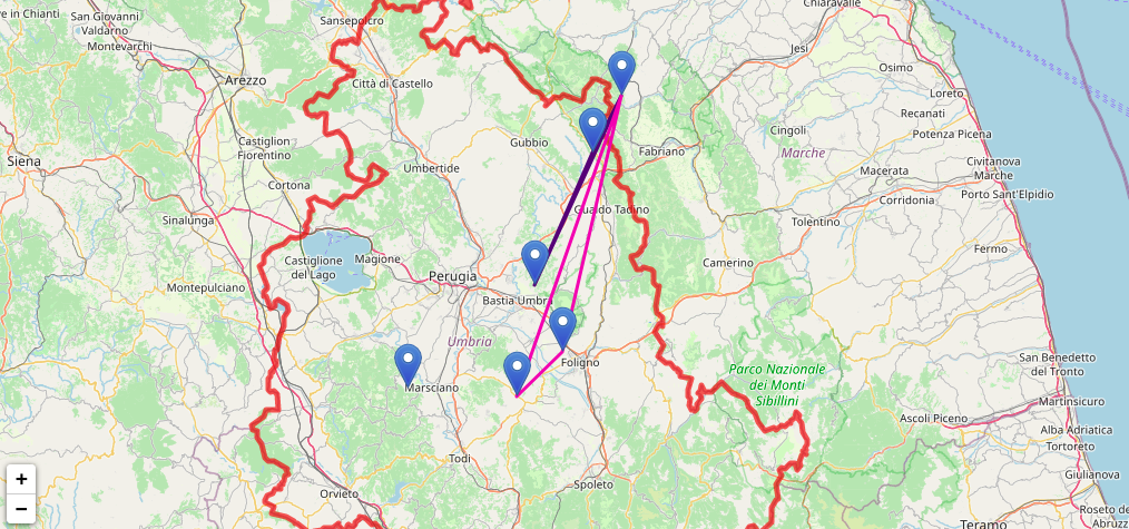
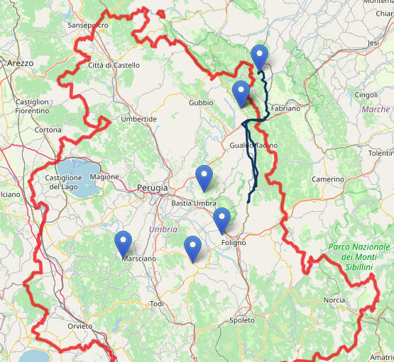
and to my map:
I’m noticing that the routing pass throug steps but not respect street directions, cut the streets over.
Where I’m failing?
thanks a lot.