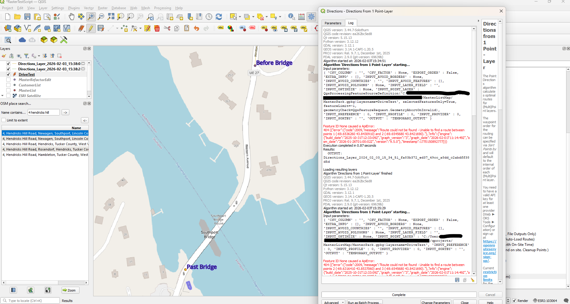
Found this weird issue where points in the town Southport Maine wont route. I placed 2 points, one “Before Bridge” that gets no routing issues and one “Past Bridge” that does get routing issues. I thought that OSM might not have data for that area so I used OSM Place Search and the building right next to the “Past Bridge” point is findable.
Before making these points, I made a point at every junction between a customer of mine on the southern end of Southport and the bridge. All failed the same as “Past Bridge”
Thanks for reaching out and for taking the time to investigate and describe the issue in detail!
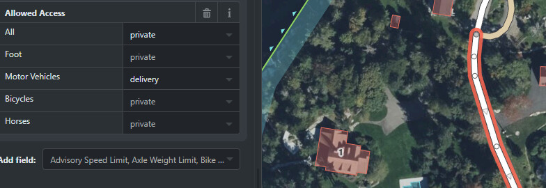
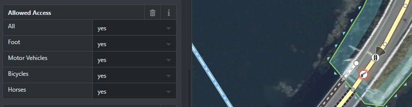
The reason for the failing routing over Southport Bridge are the lift gates 11761823136 and 11761823137. As their access status is not explicitly tagged they are assumed to be closed.
I changed both of the barriers’ access All to yes and the private way access for motor vehicles to delivery. Is there a way ORS can check for these values when routing and continue on? Perhaps a param for motorized vehicle that allows for deliveries if you don’t want to be assumptive?
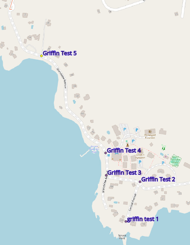
I’m cobbling together a little script to handle multi day / daily hour limit routing and I’ve got a couple customers on Grandview and in Southport. Guess the best way for now is to put a point at the closest routable road tagged “ORS REROUTE [Customer Name] and tell my script to watch out for customer names that start that way and use the time on site field from that point. Unless you think there’s a better option?
Gotcha. I’ll check if Grandview has specific signage . I do irrigation work in area so delivery / service the context in which I’ve been there. I’m unsure if there’s a more appropriate tag, I was unable to find one for “service”. Southport is definitely open to the public, the gate is only for when the bridge is swung.
I checked the tag filtering. HGV seems to pick up delivery access but still gives a “too far from road” error for that area. What if someone were to put barriers where they exist for railroad crossings? Would this trigger similar issues?
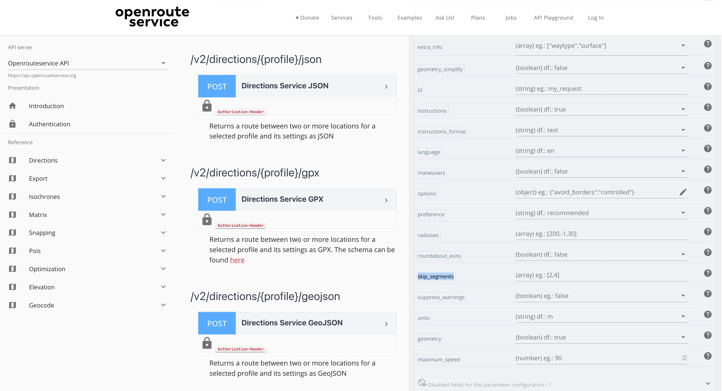
Odd, I’m not seeing skip_segmentsor even just “skip” on that page. Googled ORS tools “skip_segments” and got 3 results, 1 of which seems useful but I would like to see the documentation on that.
Overall pretty new to routing and have most of my experience in construction as-built maps. Right now I’m kind of just cannibalizing Directions From 1 Point-Layer. I’m unsure if there is a better way to call directions in qgis. I might make a separate topic for support developing my script. Not sure if that would be appropriate. So far I’ve got it 85% and just need to handle edge cases like this. Sorry if I’m making some obvious mistakes.
Edit: Grandview does have a “Visitors to Inn are welcome” for the business there so I think permissive would be correct?
Ahh I see, it’s not on the page until I click into it.
Also skip_segments could be useful, but Maine has a lot of peninsulas and my little script is doing a basic “who’s closest by coordinates” search before selecting the next route candidate. If one of my customers in South Bristol thinks they are closest by coordinates to a customer who can’t be routed in Boothbay and gets skip_segment , then it will shoot over the Damariscotta river with a short segment where i really ought to have the full route around as well as the time
Is there a way to make it route as close as possible, then skip segment? Perhaps a check for if route fails, then use snap to generate a point closest to a routable road, then skip segment, then skip segment back to the point , then route from that point to the next customer before point deletion.