Hi,
We use the ORS Direction API for distance measurements in our project. However, in some cases, there is a significant difference between the measurements obtained with the ‘shortest’ and ‘recommended’ options for the driving-car profile. In certain situations, this difference can exceed three times the distance between the two measurements.
To prevent this, we created new profiles by adjusting speed limits defined for road types, but this did not provide a complete solution for us.
Do you have any insights on why there is such a significant difference? Or any suggestions on how we can optimize this?
We haven’t been able to determine whether the source of this problem is the map data or ORS.
For a clearer understanding of the issue, I would like to share:
1. Coordinate data;
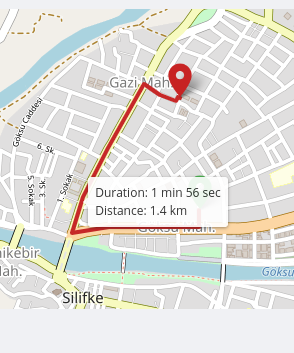
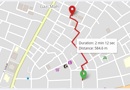
[[33.93106372015712,36.38085005546252],[33.93021614213607,36.384702374654225]]
2. Measurements obtained through the ORS interface;
Reccomended;
Shortest;
We believe that the measurement made by ORS for ‘recommended’ is inaccurate here because it seems to calculate the route longer than necessary for a very close point.
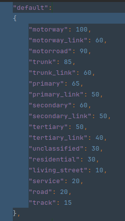
We recalculated these measurements using the new profile we created by updating the code with the following speed limits;
-Default speed limits;
-Updated speed limits;
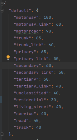
But the result remained the same.
If it’s related to ORS, do you have any recommended configuration changes or any other methods you could suggest for us?
Thx