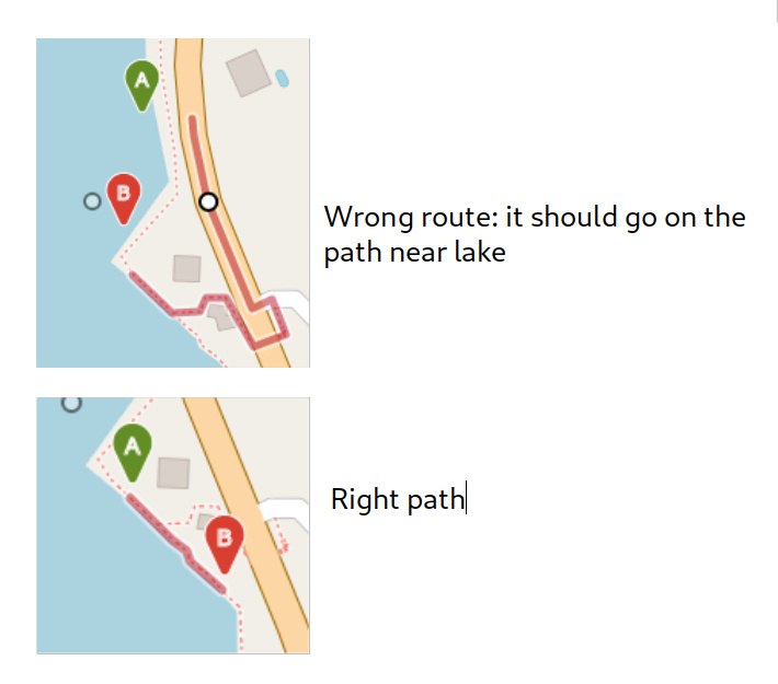
I’m trying to tell openrouteservice to make a walking path. First itinerary:
Second itinerary, a few meters in south:
Screenshot:
Why, in the first itinerary, openroutservice gives me the highway road (it is forbidden to go by walk, too) and the second it gives me the correct result?
@lucamanga looks interesting  could you please do us a favour and provide the OSM way_id links from https://openstreetmap.org ?
1 Like
Just for information: These paths were touched 19 days ago. Could be that the lower one was there already and the one above was created and is not yet in the graphs. I guess @lucamanga you might have some insight, as the
change was introduced by Luca_76 ? 
1 Like
 could you please do us a favour and provide the OSM way_id links from