Hello and thanks a lot for this great service.
I am an openstreetmap contributor and use your routing service for various purposes.
I have some comments on the new ORS layout:
the “topography” scheme is great. Is it possible to include that in the classical layout?
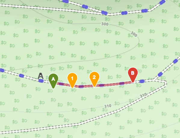
There should be numbered labels on the waypoints, as in the classical layout. It is otherwise very cumbersome to assign or connect the map waypoints to the table.
It is convenient to have this “direct routing” option in the table. However, direct routing will lead to a mess-up in the elevation profile. I assume that you have already noticed this because it is very obvious. I can send a screenshot to explain further, if required.
Keep up the good work and best wishes from Heidelberg
Christian
It is not planned to include any new features in the classic client, see:
I guess with topography scheme you mean the base map?
If you want, you can implement it and open a pull request to the classic client, i can then review it.
Regarding the other 2 issues, please check open issues in the repository:
Hello, and thanks for the feedback. Please see attached, old vs. new. I do not see the number labels in or near the route markers and could not find a way to turn that feature on.
Best wishes
Christian! ors-new-no-labels|573x487 ors-old-with-labels|598x459
