Hi all,
I came across the term “sidewalkify” on another OSM based accessibility friendly router. I’ve read your answers regarding pedestrian and wheelchair routing. I’d like to ask your opinion on this.
sidewalk=* tagging allows very nice explanation of sidewalks, without drawing a lot of extra lines, connections, very low level details. And wherever I saw footpaths drawn separately in OSM, I spotted connection errors very soon. So I’d prefer having one stable network of roads (i.e. highway=residential) instead of 3 parallel networks drawn manually (foot, car, foot).
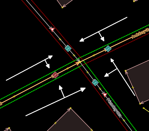
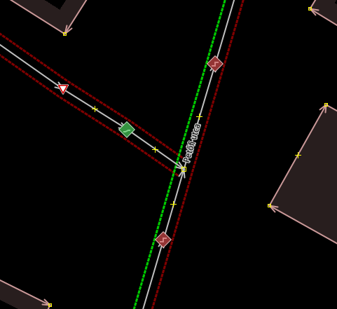
Please consider this example. The sidewalk=* tag values are visualized by JOSM style “Sidewalks and footways (with knobs on)”. Red lines are sidewalk no, green is yes (left or right accordingly). The square kerb icons are highway=crossing + crossing=* + kerb=* + tactile_paving=* (they indicate kerb value).
“Sidewalkify” would mean, that your routing engine calculates the sidewalks based on the sidewalk=* and sidewalk:= tags.
At this corner, the theoretical sidewalk crosses the crossing street at the green “lowered kerb” marker. If pedestrian needs to leave the sidewalk for routing reasons here, then they can choose either the “raised kerb” (red) directly to the same road where sidewalk was present, or the lowered kerb to the connecting road (and optionally continue on the sidewalk over it), OR use the lowered kerb via connecting road to the reach the original road in a wheelchair friendly direction. (Hope you can follow. I tried to keep the example simple.)
So basically OSM mappers would need to draw all crossings like we draw zebra crossing from the beginning of OSM project: a node on the street where pedestrians cross the road.
Adding extra attributes (kerb, wheelchair) will help wheelchair routing. Anything tagged as sidewalk:left:= (or right) would be considered accordingly, or e.g. sidewalk:surface=*.
Do you have anything like that in the system or what do you think? (I have a detailed idea for mapping this way - so I wanted to see if it would be useful ever. I find it easy to mark “possible crossing points” and their attributes. Much easier than actually drawing and then maintaining all sidewalks.)
Thank you,
Kempelen