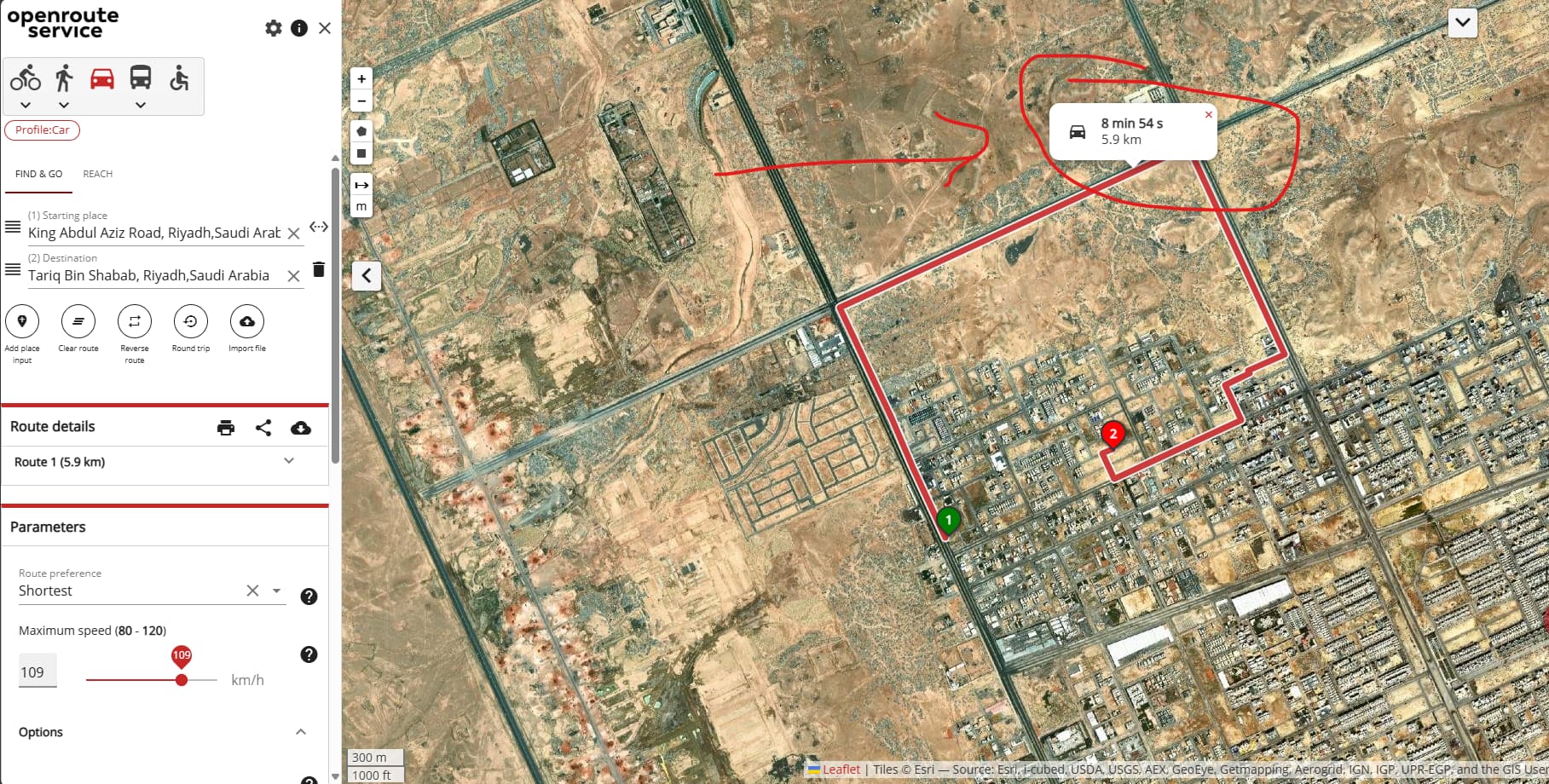
- ORS Result: 5.9 km – around 6 minutes
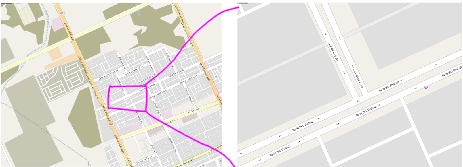
- Google Maps Result: 2.3 km – around 3 minutes (via King Abdul Aziz Branch Rd)
From visual inspection, Google Maps picks a shorter, more direct road through residential streets, while ORS takes a longer external route along the main road.
I understand ORS relies on OpenStreetMap data, but is there any way (via request parameters or routing preferences) to make the ORS route behave more like Google’s shorter option?
For example:
- Should I use
"preference": "shortest"instead of"fastest"? - Can I adjust
"maximum_speed"or other parameters to discourage long detours on highways? - Is this a data issue in OSM for this specific area?
I’ve attached comparison screenshots for clarity.
Any guidance or parameter tuning suggestions would be appreciated!
curl --location 'http://ors-dev.suhail.ai:8080/ors/v2/matrix/driving-car' \
--header 'Content-Type: application/json' \
--header 'Authorization: Bearer ****' \
--data '{
  "locations": [
    [ 46.59943840509176, 24.907529306139324],
    [ 46.60296827539301, 24.906069701451187],
    [ 46.60473047427723, 24.911566019920585],
    [ 46.607737687743736, 24.910395469936603],
    [46.618946064606064, 24.912820817163635]
  ],
  "sources": [0],
  "destinations": [1, 2, 3, 4],
  "metrics": ["duration"],
  "units": "m"
}'
#openrouteservice openrouteservice > directions Maps Website #driving-car