Hello, i don’t understand the return of the API :
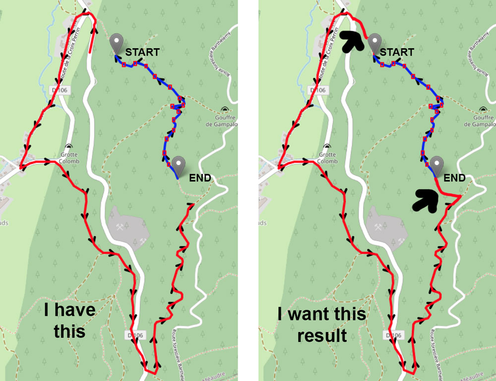
In this case, no problem
{"coordinates":[[5.556051,45.153676],[5.560765,45.147081]],"elevation":true,"instructions":false}
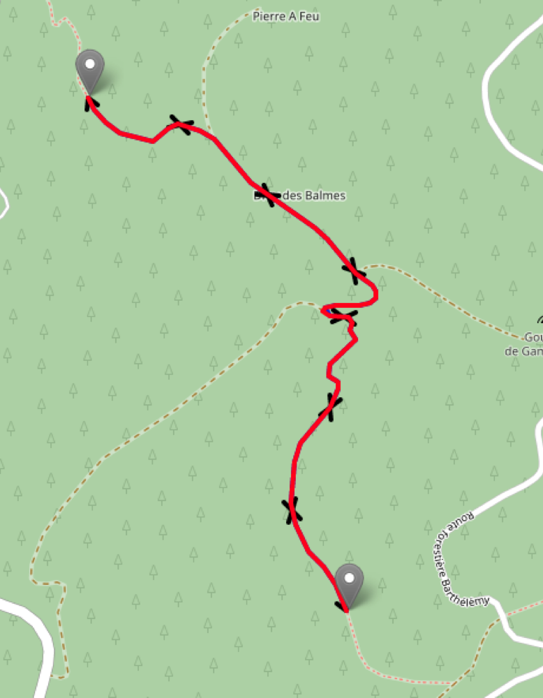
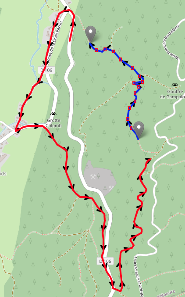
But i want route from the end to the begin of this track, so i use avoid_polygons with rectangles along (draw in red).
https://api.openrouteservice.org/v2/directions/foot-hiking/geojson
{"coordinates":[[5.556051,45.153676],[5.560765,45.147081]],"elevation":true,"instructions":false,"options":{"avoid_polygons":{"type":"MultiPolygon","coordinates":[[[[5.556546,45.153321000000005],[5.5567459999999995,45.153321000000005],[5.5567459999999995,45.153121],[5.556546,45.153121],[5.556546,45.153321000000005]]],[[[5.55741,45.153378000000004],[5.5576099999999995,45.153378000000004],[5.5576099999999995,45.153178],[5.55741,45.153178],[5.55741,45.153378000000004]]],[[[5.558247000000001,45.153238],[5.558447,45.153238],[5.558447,45.153037999999995],[5.558247000000001,45.153037999999995],[5.558247000000001,45.153238]]],[[[5.558918,45.152680000000004],[5.559118,45.152680000000004],[5.559118,45.15248],[5.558918,45.15248],[5.558918,45.152680000000004]]],[[[5.5600760000000005,45.152103000000004],[5.560276,45.152103000000004],[5.560276,45.151903],[5.5600760000000005,45.151903],[5.5600760000000005,45.152103000000004]]],[[[5.560817,45.151518],[5.561017,45.151518],[5.561017,45.151317999999996],[5.560817,45.151317999999996],[5.560817,45.151518]]],[[[5.561079,45.151142],[5.561279,45.151142],[5.561279,45.15094199999999],[5.561079,45.15094199999999],[5.561079,45.151142]]],[[[5.560261000000001,45.151072000000006],[5.560461,45.151072000000006],[5.560461,45.150872],[5.560261000000001,45.150872],[5.560261000000001,45.151072000000006]]],[[[5.560725000000001,45.15079],[5.560925,45.15079],[5.560925,45.150589999999994],[5.560725000000001,45.150589999999994],[5.560725000000001,45.15079]]],[[[5.560350000000001,45.150347000000004],[5.56055,45.150347000000004],[5.56055,45.150147],[5.560350000000001,45.150147],[5.560350000000001,45.150347000000004]]],[[[5.560350000000001,45.149791],[5.56055,45.149791],[5.56055,45.149590999999994],[5.560350000000001,45.149590999999994],[5.560350000000001,45.149791]]],[[[5.559824,45.149330000000006],[5.560023999999999,45.149330000000006],[5.560023999999999,45.14913],[5.559824,45.14913],[5.559824,45.149330000000006]]],[[[5.559642,45.148569],[5.559842,45.148569],[5.559842,45.148368999999995],[5.559642,45.148368999999995],[5.559642,45.148569]]],[[[5.559969000000001,45.147945],[5.560169,45.147945],[5.560169,45.14774499999999],[5.559969000000001,45.14774499999999],[5.559969000000001,45.147945]]]]}}}
What can be the problem ?
Thanks