Hi ORS team,
the Stadtvermessungsamt Frankfurt is testing the ORS in cooperation with the Bundesamt für Kartographie und Geodäsie BKG und the Masterportal projekt. It shall be used by the educational authority for routing of pupils the school.
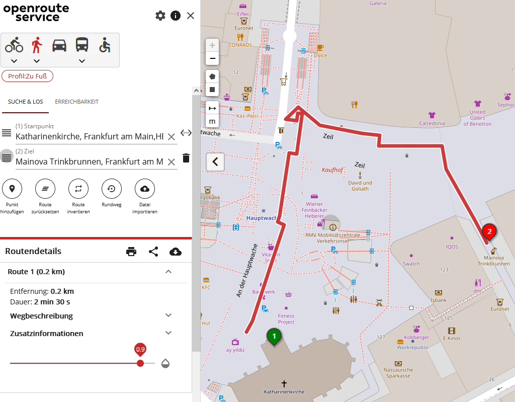
During testing we discovered a strange route at Frankfurt Hauptwache from the entrance of “Katharinenkirche” to the “Mainova Trinkbrunnen”.
Start: underground platform “Hauptwache”, level -4
footways indoor, level -4
underground platform “Hauptwache”, level -4
footways indoor, level -4
footways indoor, level -2
stairway, level -1
footway
pedestrian street “Zeil”
pedestrian street “Liebfrauenstraße”
Unfortunately the routing starts at underground platform “Hauptwache” at level -4 and not in the pedestrian street “An der Hauptwache” or “Zeil”.
The Hauptwache is certainly an extreme example.
Above ground: Square “An der Hauptwache”
B level: “Hauptwache Passage”
level -2: S-Bahn and U-Bahn
level -3: underground
Thanks in advance!