Hello,
I successfully built the Europe map with ORS (about 12 hours, no problems or errors).
However, when I enable the European borders (add all the boundaries etc.), the build starts but then gets stuck during graph creation. I don’t get any errors, only the following log output:
ors-app  | 2025-08-18 12:20:45 INFO                                            ORS-pl-car [ o.h.o.r.g.e.r.b.CountryBordersReader     ]   Border geometries read
ors-app  | 2025-08-18 12:20:45 INFO                                            ORS-pl-car [ o.h.o.r.g.e.r.b.CountryBordersReader     ]   37 countries read in 1 hiearchies
ors-app  | 2025-08-18 12:20:45 INFO                                            ORS-pl-car [ o.h.o.r.g.e.r.b.CountryBordersReader     ]   37 country IDs read
ors-app  | 2025-08-18 12:20:45 INFO                                            ORS-pl-car [ o.h.o.r.g.e.r.b.CountryBordersReader     ]   Border ids data read
ors-app  | 2025-08-18 12:20:45 INFO                                            ORS-pl-car [ o.h.o.r.g.e.r.b.CountryBordersReader     ]   Border openness data read
ors-app  | 2025-08-18 12:20:45 INFO                                            ORS-pl-car [ o.h.o.r.g.e.ORSGraphHopper               ]   version v4.9.1|2024-01-17T09:08:46Z (7,20,5,4,5,7)
ors-app  | 2025-08-18 12:20:45 INFO                                            ORS-pl-car [ o.h.o.r.g.e.ORSGraphHopper               ]   graph CH|car_ors|RAM_STORE|3D|turn_cost|,,,,, details:edges:0(0MB), nodes:0(0MB), name:(0MB), geo:0(0MB), bounds:1.7976931348623157E308,-1.7976931348623157E308,1.7976931348623157E308,-1.7976931348623157E308,1.7976931348623157E308,-1.7976931348623157E308, shortcuts:0 (0MB), nodesCH:-1 (0MB), shortcuts:0 (0MB), nodesCH:-1 (0MB), shortcuts:0 (0MB), nodesCH:-1 (0MB)
ors-app  | 2025-08-18 12:20:45 INFO                                            ORS-pl-car [ o.h.o.r.g.e.ORSGraphHopper               ]   No custom areas are used, custom_areas.directory not given
ors-app  | 2025-08-18 12:20:45 INFO                                            ORS-pl-car [ o.h.o.r.g.e.ORSGraphHopper               ]   start creating graph from /home/ors/files/europe-latest.osm.pbf
ors-app  | 2025-08-18 12:20:45 INFO                                            ORS-pl-car [ o.h.o.r.g.e.ORSGraphHopper               ]   using CH|car_ors|RAM_STORE|3D|turn_cost|,,,,, memory:totalMB:24576, usedMB:902
At this point the process doesn’t move forward. I let it run for almost 3 days, but it still never finished creating the graph, and the status remains “not ready.”
When I disable borders, the build works fine.
When I enable borders, no errors appear, but it seems to hang indefinitely.
Here my configuration:
server:
port: 8080
error:
whitelabel:
enabled: false
enabled: true
ors:
cors:
engine:
source_file: /home/ors/files/europe-latest.osm.pbf
profile_default:
service:
maximum_distance: 100000000
profiles:
car:
encoder_name: driving-car
enabled: true
elevation: true
extra_info:
- countryinfo
ext_storages:
WayCategory:
HeavyVehicle:
WaySurfaceType:
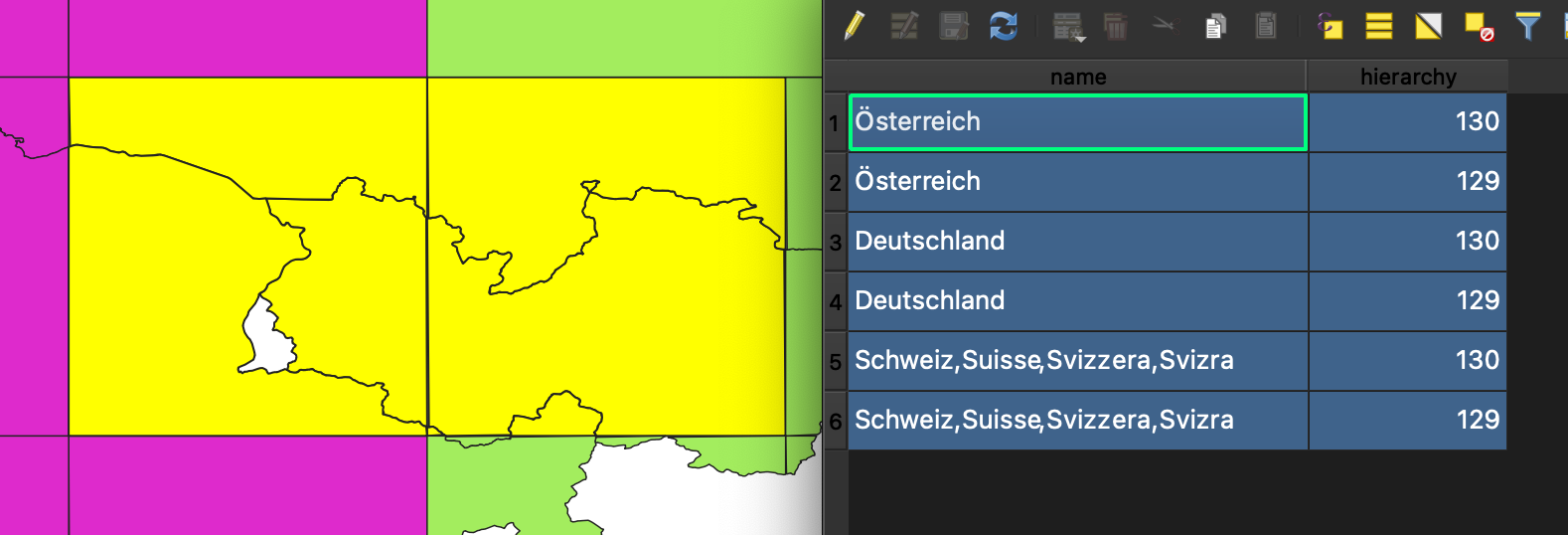
Borders:
preprocessed: false
boundaries: /home/ors/borders/borders.geojson
ids: /home/ors/borders/ids.csv
openborders: /home/ors/borders/openborders.csv