Greetings,
I’m working on a project using the ORS API. So far everything have been working extremely good, but I noticed a weird behaviour today. On one of my direction calls, there is the starting point of a specific route that is located on the other side of a river and is, thus, impracticable.
I did a schema :
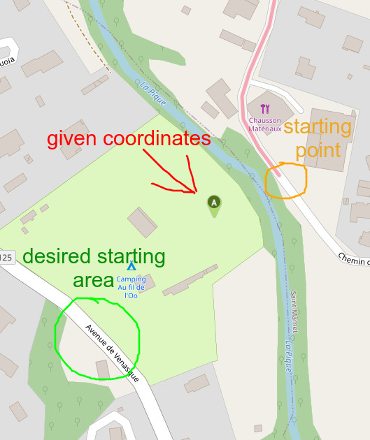
The input coordinates are generated from the camping site (in light green). The entrance of this camping site is located on the side of the desired starting area, on the “Avenue de Venasque”.
I browsed through the topics and came to the conclusion that it might be a problem with Openstreetmap not properly handling the river. I however checked and it appears that the river is recognized in the good location (although I’m not an OSM expert).
Any idea on why is it reacting like that ?
Thank you very much,
Landry