Import gpx not showing route

Hi,
I want to plot a gpx file based on GPS data extracted from pictures using exiftool. After import on i see the waypoints, but the route is not plotted and no idea why. See screenshot.

Also tried the classic version of ORS i saw searching this forum, but nothing happens when i click the import button.

How can i attach/upload the gpx file? As picture it wouldnt work

Kind regards
Wiebe

Hi @Serenwipity2,

The amount of waypoints exceed the total allowed of 50.
That’s why it won’t render a route.
You could paste the content as text in a codeblock (starting and ending with ```)
You might be able to do 3 separate routes with part of the full route, by splitting the gpx file.

Best regards

1 Like

hi,
Thanks for the quick reply.
Next problem is it cannot find suitable points for routing using car profile. Bike or walk profile work. Is there a setting to widen search for suitable point?

Regards
Wiebe

Hi @Serenwipity2,

currently not with the map client.
If you use the API directly you have a lot more options like setting the radiuses parameter for the waypoints to increase the search radius.

Feel free to open an issue for the map client in its repo for supporting the radiuses parameter.

Best regards

hi,
How to use the api?

As an alternative can i install openrouteservice in docker using portainer? I have docker already running on my NAS.
Is there a tutorial for using portainer to make the container?

how to use api?
https://api.openrouteservice.org/

Is there a tutorial for using portainer to make the container?
→ not from us, we have a docker tutorial (last link on above site)

Best regards

Hi,
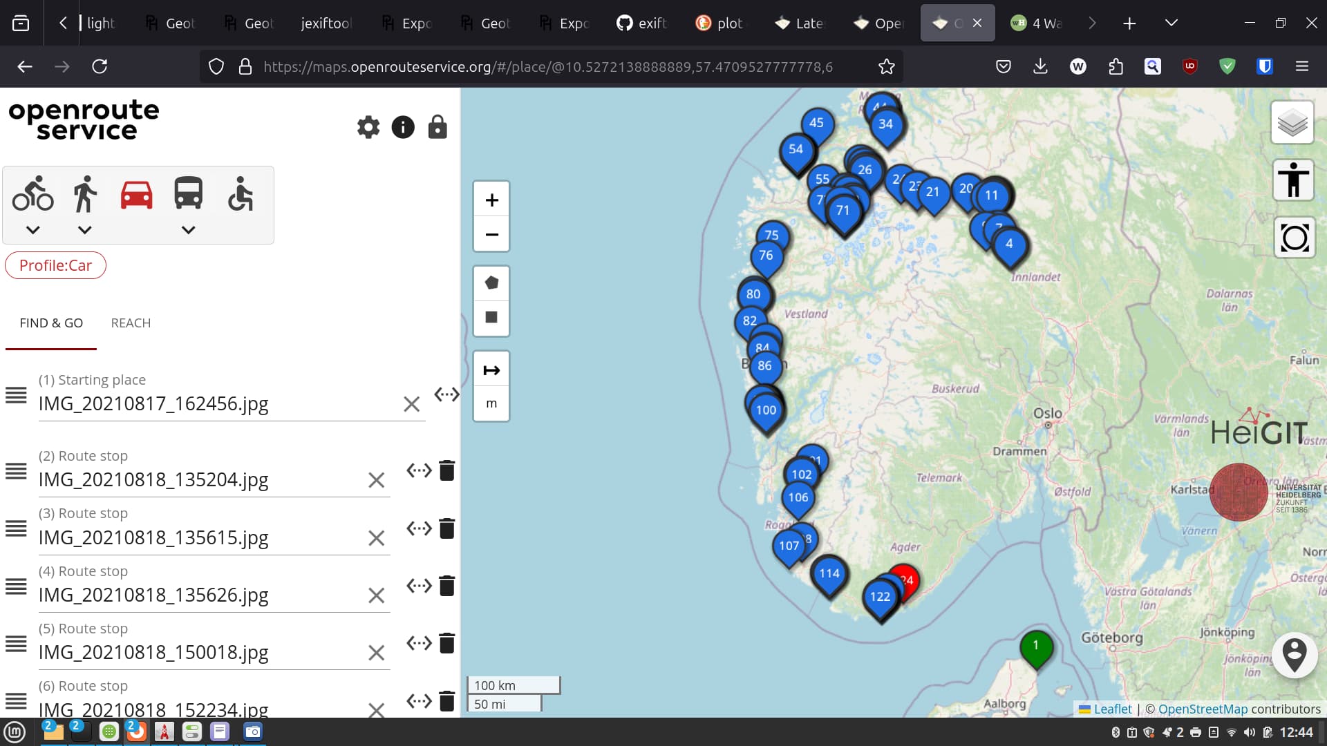
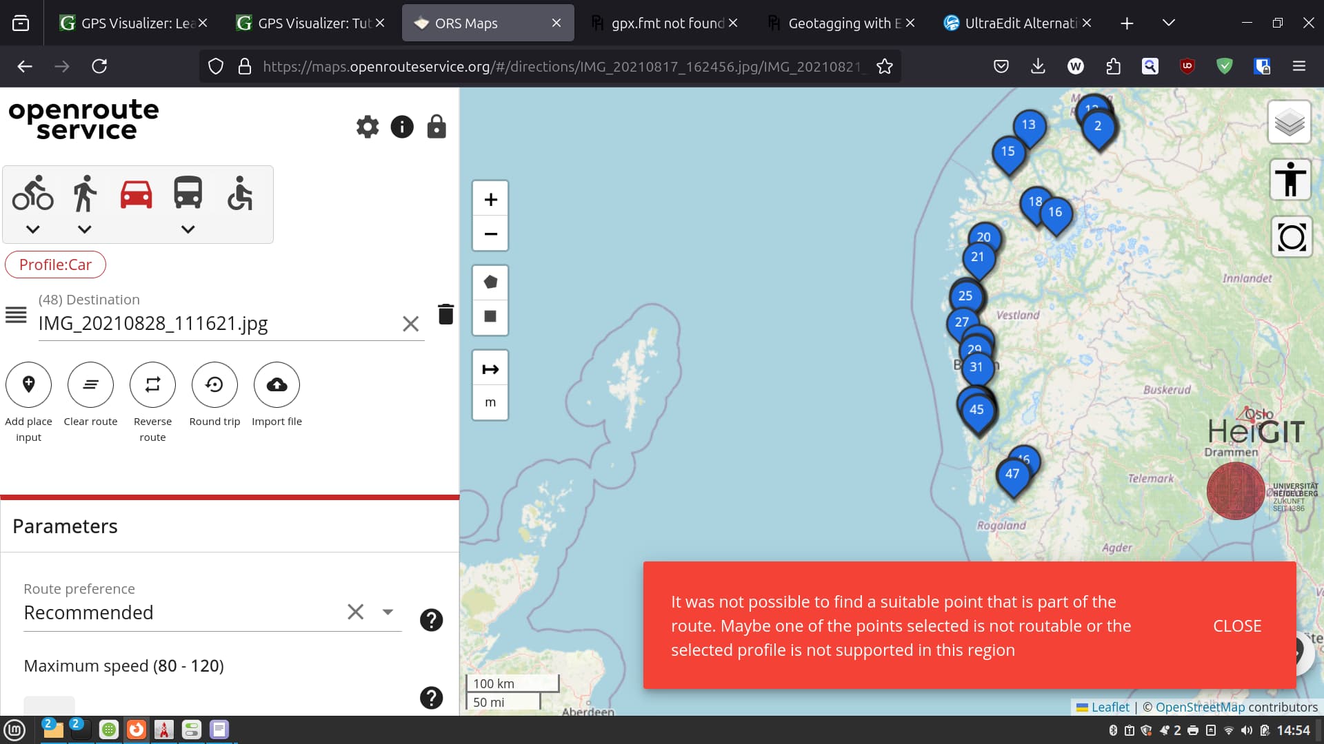
I have some trouble with the radiuses setting. i use the post driving car profile ( /v2/directions/{profile}/gpx). If i provide the coordinates (lon/lat) eg Norway of 17 waypoints:

curl -X POST \
  'https://api.openrouteservice.org/v2/directions/driving-car/gpx' \
  -H 'Content-Type: application/json; charset=utf-8' \
  -H 'Accept: application/json, application/geo+json, application/gpx+xml, img/png; charset=utf-8' \
  -H 'Authorization: xxx' \
  -d '{"coordinates":[[7.98323055555556,58.1428388888889],[7.68801388888889,58.0488583333333],[7.52954722222222,57.982175],[6.58010277777778,58.2209694444444],[6.05318611111111,58.5626888888889],[5.98569444444444,58.9751972222222],[5.36428611111111,59.817875],[5.36897777777778,59.9081916666667],[5.36749722222222,60.4947083333333],[5.13532222222222,60.9029194444444],[6.48439166666667,61.7619861111111],[5.94444166666667,62.2145722222222],[7.55061388888889,62.5786083333333],[8.22959444444444,61.8840777777778],[9.21143611111111,61.8624666666667],[9.81465833333333,61.5003222222222],[10.5272138888889,57.4709527777778]]}'

it gives an error of 2 waypoints it cannot find:
[[7.5295472,57.9821750],[6.5801028 58.2209694]]

but when i use in addition the radiuses parameter either [350,-1] (found in other topic), [350,-1,30] (default), [350,-1,17] (total waypoints) or [350,-1,2] (error wayoints) they all give an error that the radius doesnt match the waypoints (Parameter ‘radiuses’ has incorrect value of ‘[350.0, -1.0]’. The number of specified radiuses must be one or equal to the number of specified waypoints." } , .
What should it be?

If i use the snapping service ( /v2/snap/{profile}:

curl -X POST \
  'https://api.openrouteservice.org/v2/snap/driving-car' \
  -H 'Content-Type: application/json; charset=utf-8' \
  -H 'Accept: application/json, application/geo+json, application/gpx+xml, img/png; charset=utf-8' \
  -H 'Authorization: xxx' \
  -d '{"locations":[[7.5295472,57.982175],[6.5801028,58.2209694]],"radius":350}'

the server can find the waypoints within 350m

hope you can help

Hey,

running this myself, I get

Route could not be found - Unable to find a route between points 3 (7.5295472 57.9821750) and 4 (6.5801028 58.2209694).

which is quite a bit different from

In this case, looking at the map shows point 4 being on Hidra island, with only a ferry connecting this.

It turns out that there is a ferry, yet it’s handled incorrectly.
There is a fix in progress that will be included in the next release.

EDIT: Fix ferry tag handling by koebi · Pull Request #1954 · GIScience/openrouteservice · GitHub is the mentioned fix

Best regards