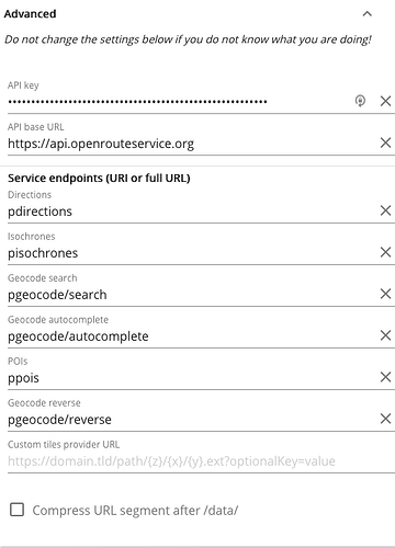
Hi @grokier,
In the settings there is an option to not compress the URL (last point in advanced).
You could potentially use this to generate your avoid polygons from the URL.
Bear in mind:
- that the avoid polygons currently are limited to 200.000 square meters
- too complex polygons might result in an invalid URL as it has a character limit of around 2000
an example would be:
https://maps.openrouteservice.org/#/directions/Aldi%20S%C3%BCd,Bobenheim-Roxheim,Deutschland/A%20656,Heidelberg,Deutschland/data/%7B%22coordinates%22:%228.34892272949219,49.58133565487736;8.639373779296877,49.41544050977336%22,%22options%22:%7B%22profile%22:%22foot-walking%22,%22preference%22:%22recommended%22,%22options%22:%7B%22avoid_polygons%22:%7B%22type%22:%22MultiPolygon%22,%22coordinates%22:%5B%5B%5B%5B8.400764,49.516293%5D,%5B8.418274,49.52298%5D,%5B8.417931,49.513618%5D,%5B8.417931,49.513618%5D,%5B8.400764,49.516293%5D%5D%5D%5D%7D%7D,%22zoom%22:18%7D%7D
Best regards
