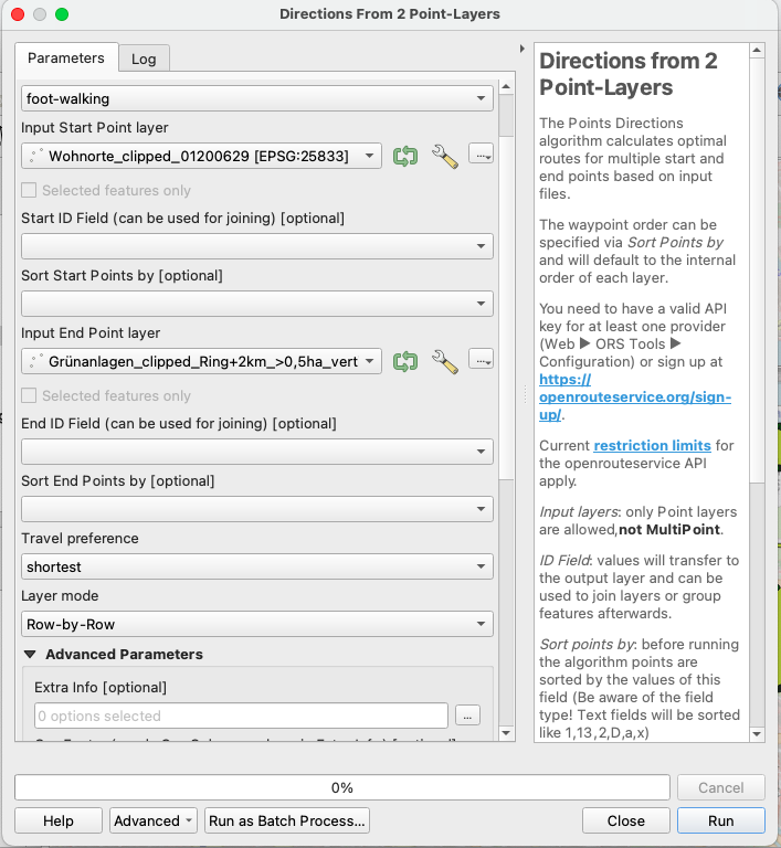
Hi! I want to find the shortest route between given starting points (orange) and a selection of endpoints (Green). Only the route to the nearest endpoint should be displayed. But the tool produces routes (purple) to endpoints that are much more far away. Am I Doing something wrong?
Best regards!

Hey,
it is a bit hard to understand what is going on here.
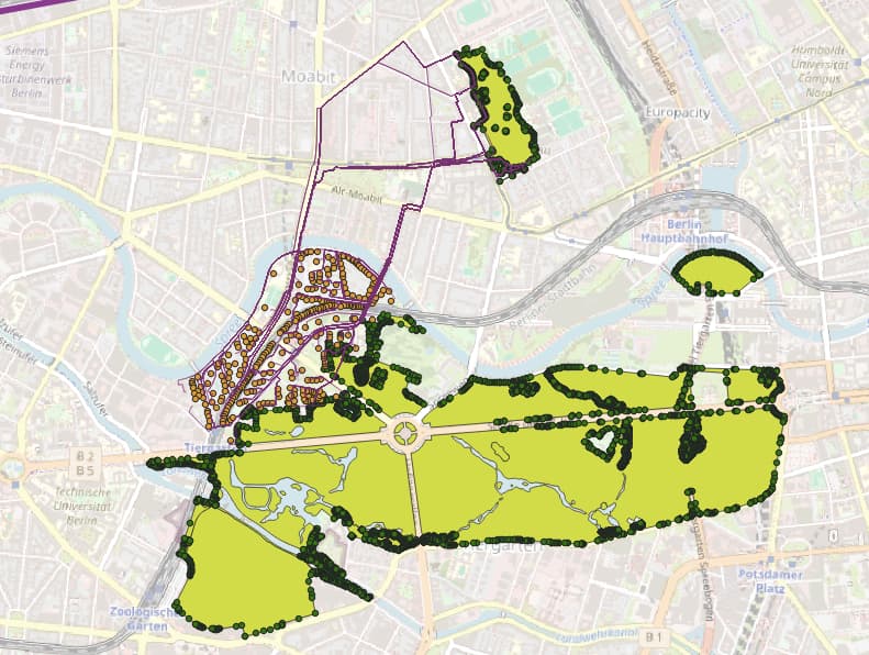
As I see it, the map shows a bunch of start points in orange and a bunch of end points in green.
You selected the Row-by-Row Layer mode.
It seems like your start point layer (the orange points) has fewer starting points (let’s say 97) than your end points layer (the green points). Thus, you will only get directions from your 97 starting points to the first 97 end points, row by row.
The first 97 are determined by the ordering of your point layer, not by closeness of any sort.
This is information you’d have to determine differently, maybe by a matrix request (and then sorting by distance ) or by an isochrone request (and then cutting off anything outside of the reachable area).
Everything that follows is unsolicited advice, so feel free to ignore it completely ![]()
Taken from the name of your end point layer, it looks like you are looking for entrances to green spaces.
However, the “Spreebogenpark” south of the Berlin main station looks like it has a gazillion entrances spanning the whole northern border.
Looking at the map, I’d guess that an entry is anywhere where a non-greenspace road meets the greenspace, and thus, there should be around 5-6 entrances - one at each bridge and two or three at the southern corners or maybe the midpoint of the southern border.
An approach like this would drastically reduce your number of entrances and thus make an “All-by-All”-Approach feasible.
Best regards.
Thank you so much for your quick and detailed answer!
The Information about the Order of my ending points is really interesting!
You’re right, i called the layer “entrances” but its actually just the breaking points between the different polylines Building the given Green space. It’s just a way to put the Outline of the Green space into a Point layer. I should reduce them.
I just thought, maybe for pedestrians there are more ways to get into a Green space, than only by a normal road. So i wanted to give the tool as many possible entrances as possible. But maybe thats a bit much…
Anyways, thank you a lot!
1 Like