Hello,
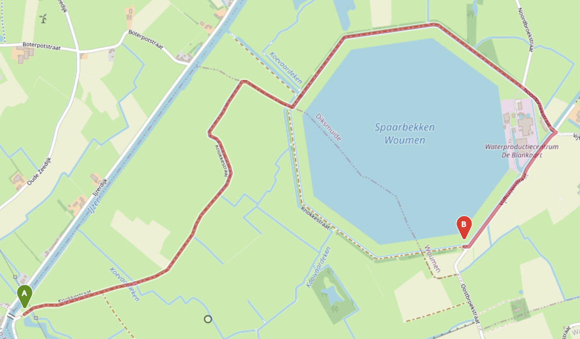
On marks 50.981563469314644, 2.8068405389785767 to 50.9842348201083, 2.8338503837585454
Is marked as bicycle route.My work uses this route te calculate my distance to home.
It is forbidden to cycle there by sign C1 on both directions.
I have some pictures of the signs if needed.
Please change this so the distance to my work will be corrected.
Thanks.
Hey,
it is a bit hard to understand your issue without some visualization.
I assume you are talking about this route:
https://classic-maps.openrouteservice.org/directions?n1=50.983941&n2=2.828939&n3=15&a=50.981563,2.806841,50.984235,2.83385&b=1a&c=0&k1=en-US&k2=km
The openrouteservice uses OpenStreetMap-Data to calculate its routes, and any allowance or non-allowance of bike routes is going back to the corresponding ways being marked as accessible to bikes or not.
Could you make it a bit clearer, on which ways (ideally, OpenStreetMap ways) cycling is not allowed?
The ways from the route above, e.g. Way: Knokkestraat (89476850) | OpenStreetMap or Way: Knokkestraat (52589507) | OpenStreetMap do not forbid bike routing - on the contrary, the first even explicitly allows it via the bicycle=yes-tag.
If there is an error in the OSM data, then please do feel free to correct it. If you don’t know how, lte us know and we will point you to all relevant documentation 
Best regards
1 Like
Hello,
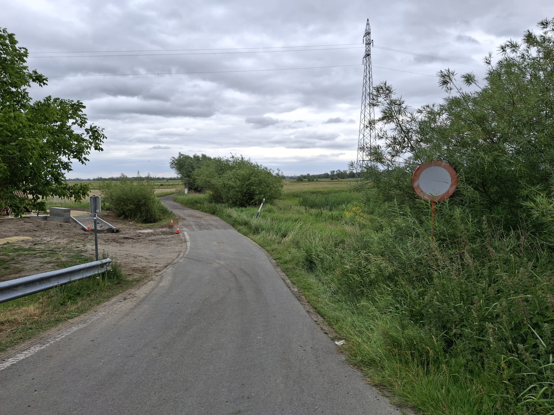
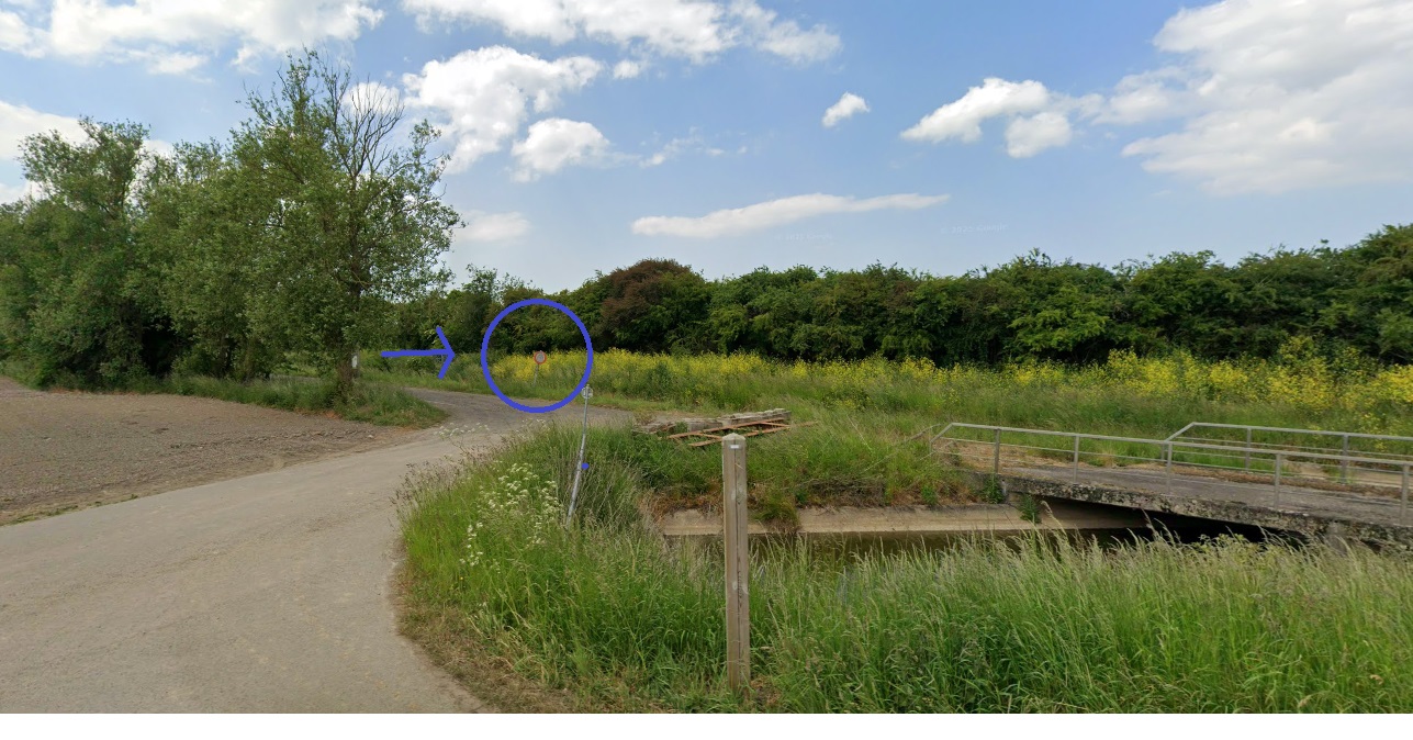
Indeed, the above route. It is on both ways not allowed to cycle there. These are roads only to be used by famers. (see the pictures of signs on both ways (A and B)
I ask this becouse my work employee uses your tool to calculate my bycicle disctance to the workplace. Thats why i want it to be corrected. The road is forbidden for bikes by the C1 sign and also not verry ridable. (in the winter it floods and there are lot of holes from the farm machines). So can you change the bicycle tag to no?
Thank you verry mutch.
Location A
Location B
Hey,
looking at Street-Level imagery on google maps makes it look like the picture of location B was taken from there.
Do you have a picture that you took yourself that is maybe even a bit more recent?
Regarding location A, did you take that picture yourself?
To be fair, I’d rather you change the map yourself, as you know best on what routes biking is actually not allowed, whether things are under construction (as it looks like in location A) and everything else. If any questions arise, you are knowledgeable around the area and can set things into context.
The beginner guide on learnOSM is a great intro to the OpenStreetMap
Best regards
Hi,
Location A, indeed i took the picture myself.
B not, but if you want i can take a picture. its still the same as in street view.
I dont know how to change the route. as i have said i just want it to be corrected so my work calculates my kilomters correct.
Hey,
understandable - however, we do not specialize in remote commisioned OSM editing 
In fact, this is even discouraged, in a way
The OpenStreetMap is a community project trying to map the world, one road and building at a time.
You (or rather your work, as they are using the openrouteservice, which in turn is using OpenStreetMap data) are profiting from the free work and open data this project provides.
Unfortunately, with this freedom also comes the obligation to help out whenever you see a need, for example by correcting wrong information in the OpenStreetMap that make the routing using the OSM data wrong.
I understand that it may seem daunting to go edit the OSM, but the resources and tooling around this have vastly improved over the last years. It is now as accessible as ever.
In your case, creating an account, going to the respective map area on openstreetmap.org, clicking “edit” and then changing the access tags on the roads that need changing should be all it takes - and some time for the openrouteservice to pick up the changes.
The default OpenStreetMap in-browser editor (called iD) even has an interactive walkthrough inside the editor, which you see when you first access it.
Feel free to leave your username here, ideally even your changeset number, and I’ll gladly have a look at your changes.
Best regards
1 Like
Ok,
Thank you verry much for the information.
I changed the route options.
My username is jjaann3
changeset number is 178979363.
1 Like
Hey,
great, thanks a lot!
From my side, your changes look good
The only thing that confuses me a bit is Way: Knokkestraat (89476850) | OpenStreetMap where you changed the access from access=destination to access=permit.
As stated on the wiki page for the access=permit tag, this is reserved for routes where a permit is required, but routinely granted.
Ideally, a sign should specify that.
In this case, it’s a bit hard for me to imagine that this is indeed the case for the mentioned street - but I might be wrong here
Best regards
1 Like
There is no sign but i know this becouse my workplace has a permit. But it is indeed strange that this is not specified by signs