Hi all,
I’m a bit new to OpenRouteService, so please excuse me if this is a naive question, but I am having trouble making sense of the directions service geoJSON output, in particular, the definition of the keys for tolls. For my project, I’m interested in the tolls one can encounter along a path, and when I run my query the relevant output looks like this:
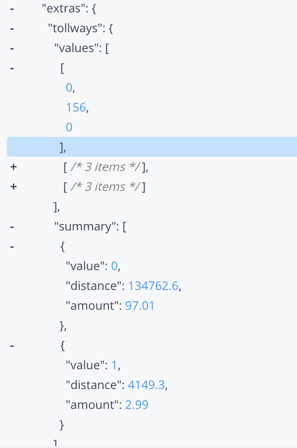
My questions are:
- What does the array output under the "values’ key signify?
- Under summary, from the only documentation I can find (GitHub - GIScience/openrouteservice-docs: 📝 This repository stores the swagger specifications of the openrouteservice API. Browse to swagger for a detailed overview.), it seems like a value of “0” indicates that stretch of distance doesn’t have tolls while a value of “1” indicates that stretch of distance does. Is this correct?
- What are the units of “amount”? For reference, I queried directions from New York, NY, USA to Philadelphia, PA, USA. Does it know to use USD? Also, is “amount” the total value of tolls over that distance? If so, why is amount a positive number under the stretch with “value”: 0, which I presume means this stretch has no tolls?
- Finally, is there any way to get a list of toll roads on my path and their respective tolls?
Any help with this will be much appreciated! Also, if I am missing some documentation out there on the internet please point me in the right direction. Thanks very much in advance!