Tyvm I was not using this latest one. I need one more help. I used Directions and it gives me json as segments. But what gives me coordinates instead? Thanks in advance
The origin and destination are Chennai and Kanchipuram of India
It returns features->geometry as
…
2010
“Could not find routable point within a radius of 350.0 meters of specified coordinate 0: 12.8521340 80.1401110.; Could not find routable point within a radius of 350.0 meters of specified coordinate 1: 12.2287612 79.5596750.”
…
But in old coding it (leaflet routing machine ) return coordinates correctly
Also for Western cities it returns correctly under features->geometry in the form of my needed coordinates
Is it feasible for south indian cities?
const body = '{"coordinates":[[12.2287612318, 79.5596749969],[13.0832,80.2755]]}';
request.send(body);
I was expecting features>geometry array. Now currently it shows error 2010 radius 350 error
switched coordinates same error
ETA:
I need what are the openrouteservice coordinates for Chennai. Can i find it on openrouteservice playground?
Additionnaly it seem that your stating point is nowhere near a driveable Road is that correct?
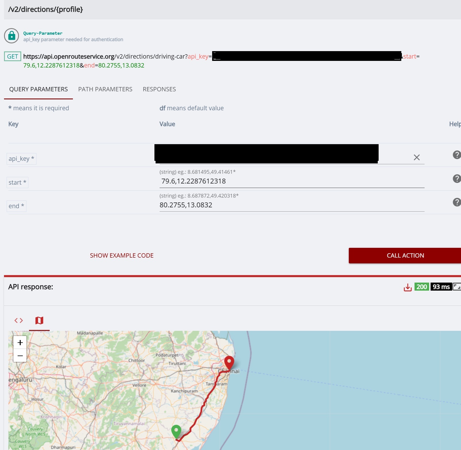
API playground request with slightly different starting point :
Whoa thanks for finding the correct coordinates. Could you give me exact start coordinates? they are not accepting in script for start. same error for start only
End is working
No problem if start is farther from current coordinate.
also you forgot to hide the apikey from bottom textbox
If you need coordinates just right click on google map to show the locations coordinates ( in lat,long), just pick a point on a road if you want to be sure to get a response
Thanks a lot it is working
I have a doubt. When I place two maps on a page, only first one is loading. Is it possible to place 2 maps on same page? Thanks in advance
(map_libregl maps)