I am using a self-hosted OpenRouteService. It was working fine, but now I am getting an error when trying to find coordinates between two destinations at some time.
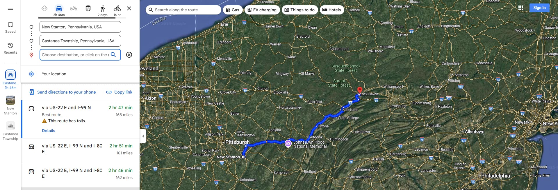
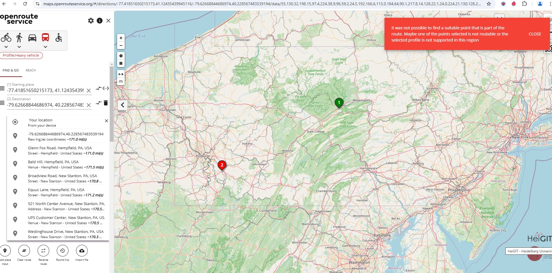
I am trying to find a route between two destinations, but I am encountering an error. I have attached a screenshot for reference.
In Google Maps, we can move the pointer to get coordinates. In OpenRouteService, is there a way to find the nearest coordinates to get directions between two locations?
Hi @RajeshVE22,
could you please provide the actual request (or the url from the map client).
Best regards
I want to get coordinates from these points:
- Point A: 40.228567483539194, -79.62668844686974
- Point B: 41.12435439945116, -77.41851650215173
However, when I check, it doesn’t provide me with any routes.
Hey,
the issue here is that your coordinate
is too far from any routable road.
The closest road is this OpenStreetMap way, which is tagged with access:private and thus the openrouteservice correctly doesn’t use it for routing.
I can think of three options why gMaps does find a route:
- The road is incorrectly tagged as
private
Given that this is an Amazon Center, I find it quite reasonable that this is private - I cannot imagine Amazon likes anybody driving on their properties. - The road is correctly tagged as
private, but gMaps doesn’t know about that.
To me, this is the most likely explanation - The road is correctly tagged as
private, gMaps knows about this, but chooses to ignore it.
I simply hope that that’s not the case^^
Best regards
2 Likes
Hi jschell
Thanks for reply
“Does OpenRouteService have an option to find the nearest alternative route point in these types of conditions?”
Hey,
you can try playing with the radiuses parameter, see our interactive API documentation for details.
Pay attention though:
The ors.engine.profiles.<profile>.service config parameter maximum_snapping_radius must allow for the values you input.
Check our backend docs for details.
Best regards