I can not set a direct waypoint via right mouse-click “direct waypoint” to f.ex.: 47.651021, 14.292344 - instead a got an error:
Code 2010: Could not find point 1: 14.2912600 47.6487080 within a radius of 350.0 meters.; Could not find point 0: 14.2909060 47.6476530 within a radius of 350.0 meters.
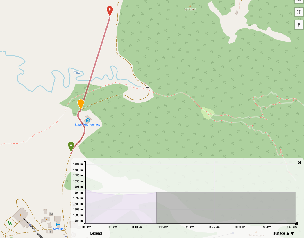
PS: The points set as direct waypoints are shown as ‘Type: no data’
Do you really want to go there by car?
I don’t think highway=track are included in the driving-car graph.
If you switch the profile to hiking or walking it should work
Edit: The problem here is, that also the route between the start and the first waypoint is not found for the car profile, as the whole area is not routable for car. I think normally tracks should even be included in car routing. So this might also be a case of the whole area not being included in the graph because it is an “island” due to some access restriction on some ways.
The elevation graph showing “no_data” and being flat-lined is actually also how it should return the information. There can’t be any extra info derived from the direct segment .
If you would add another waypoint further down the way, it would pick the height up again correctly.
The indicated descent of 2m is not correct as it should be approx. 25m … ? That means, adding other waypoints behind did not help to get the correct sums for ascents/descents …
hmm yes, the elevation could acutally be adjusted, but for other information like the route distance and duration you also will only get the “calculated” parts, as the direct segment will be skipped in the calculation.
So the info you see in the left window will not be correct for the most part or rather the information is only for the coloured part.
But in the graph on the lower left you will see a more or less correct result.