Hello there,
I love the OpenRouteService for hiking, it’s fantastic and very well designed.
I’ve recently hit a problem I don’t know how to debug : going
from 5.591827071974965, 45.392837235567754
to 5.5923901845710775, 45.39302558760163
… is not possible with ORS in hiking profile (it takes a whopping >2km workaround instead of a straight 50m!) but paths seem to be connected, and I’ve physically walked on this path, it’s fine. Would you know what’s happening ?
Also I was wondering if I could created disjoints tracks on a single map (which would work around the previous problem), with a feature like “Create new starting point” ?
Hi @zerodeux
Thanks for reaching us.
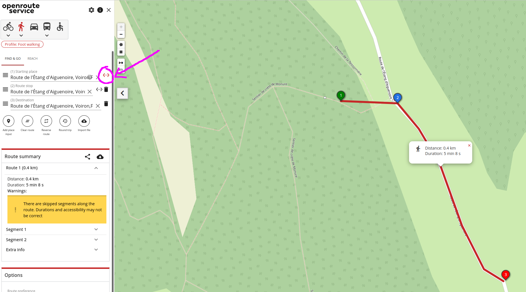
I tested your case and indeed, it is not routing through a route that is visibly there on the map. The thing is that this seems not to be an issue related to the maps client app, but some missing/wrong data about routable path on OSM database or eventually some minor issue on the ORS back-end. Maybe @andrzej can help us to understand it better.
As a way around this for now, you can use the “direct segment” functionality which in effect tells routing to not generate a route for a specific segment between two points
Thanks for you quick answer. I just learned how to query features on OSM, now it makes sense.
I’ll have a closer look the next time I follow this track and see if this access:no tag is still valid (I did not cross any forbidden or private property sign), and maybe fix it.
Thanks @amoncaldas , the workaround (direct segment) suggest by @adam fixed my problem. But I must say that the ability to “superpose” several trips on a single map has more than often itched me, maybe I’ll try a UI proposal. Thanks for the quick feedback !
I have a similar problem:
tracking from
49.70763272987024; 8.717055951229684
to
49.706328261320884; 8.717356320545184
is possible on foot, but not by bike.
The trick from adam helps.
Could it be that I just have to change the value of the tag vehicle from private to forestry of the road in OSM?
Or do I have to add bicycle yes?
regarding the question which tags lead to a way being available for a certain profile or not, have a look at our backend doumentation.
Note, that it will take some time until the changes are reflected in the ors.