it looks like Bridleways are not being used to create isochrones. In the UK, Bridleways are public rights of way for pedestrians, cyclists and horse riders, so should be used when creating these isochrones.
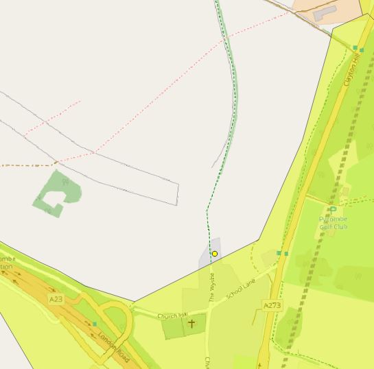
Here is an example of a 15minute isochrone : (green dotted line = Bridleway, yellow point = feature, yellow polygon = isochrone)
Hi @FrankEthos ,
the issue we have here is that in some countries bridleways are not allowed for pedestrians unless explicitly stated. Therefore, they are only used for routing (and isochrone) purposes when they have been given an explicit foot=yes tag as unfortunately we have no way of distinguishing if the bridleway is in a country that allows their use for pedestrian or not.
I have edited the relevant bridleways to foot=yes in OSM but getting the same result from the isochrones. Is there a delay between edits being made in OSM and them being used in ORS tools?
Yes we have to rebuild graphs before things take effect, and as those take a minimum of 4 days per profile we don’t generally get to do it very frequently. But over the next few weeks we should be making it so that we can update the graphs every week, so hopefully by the end of next week your changes should be in the routing system.
In OSM I’m finding that a lot of bridleways and some footpaths have been given foot=designated, rather than foot=yes. Looking at this information, it looks like these bridleways/footpaths are still usable by walkers: https://wiki.openstreetmap.org/wiki/Tag:access%3Ddesignated .
Is it possible to include bridleways and footpaths with foot=designated in the isochrone analysis please?