Area reachability

Im trying to get area around lat and long with distance of 2km
Im trying to get area around lat and long 15mins by car
But i could not find exact area…Below is the curl request

curl request :

 curl --location --request POST 'https://api.openrouteservice.org/v2/isochrones/driving-car' \
--header 'Content-Type: application/json; charset=utf-8' \
--header 'Accept: application/json, application/geo+json, application/gpx+xml, img/png; charset=utf-8' \
--header 'Authorization: xxx' \
--data-raw '{"locations":[[7.7466002,48.5830203]],"range":[300],"range_type":"time",
 "attributes":["area"],"intersections":"true","location_type":"start"}'

Kindly help in finding this

Hi @Rashmi_SN,

For me it returns this feature collection:

{
  "type": "FeatureCollection",
  "bbox": [
    7.73808,
    48.581395,
    7.766059,
    48.595129
  ],
  "features": [
    {
      "type": "Feature",
      "properties": {
        "group_index": 0,
        "value": 300,
        "center": [
          7.747652741096602,
          48.58314205519427
        ],
        "area": 2202138.7
      },
      "geometry": {
        "coordinates": [
          [
            [
              7.73808,
              48.589452
            ],
            [
              7.73867,
              48.588009
            ],
            [
              7.738909,
              48.587741
            ],
            [
              7.748243,
              48.582494
            ],
            [
              7.75638,
              48.581395
            ],
            [
              7.760384,
              48.581503
            ],
            [
              7.765553,
              48.582029
            ],
            [
              7.765696,
              48.582305
            ],
            [
              7.766059,
              48.58837
            ],
            [
              7.765824,
              48.588643
            ],
            [
              7.758488,
              48.595129
            ],
            [
              7.758415,
              48.595124
            ],
            [
              7.758261,
              48.595024
            ],
            [
              7.754641,
              48.593173
            ],
            [
              7.746079,
              48.593301
            ],
            [
              7.743362,
              48.593858
            ],
            [
              7.743044,
              48.593688
            ],
            [
              7.739041,
              48.590575
            ],
            [
              7.73808,
              48.589452
            ]
          ]
        ],
        "type": "Polygon"
      }
    }
  ],
  "metadata": {
    "attribution": "openrouteservice.org | OpenStreetMap contributors",
    "service": "isochrones",
    "timestamp": 1608723620691,
    "query": {
      "locations": [
        [
          7.7466002,
          48.5830203
        ]
      ],
      "location_type": "start",
      "range": [
        300
      ],
      "range_type": "time",
      "intersections": true,
      "attributes": [
        "area"
      ]
    },
    "engine": {
      "version": "6.3.1",
      "build_date": "2020-12-10T15:35:43Z",
      "graph_date": "2020-12-20T10:08:13Z"
    }
  }
}

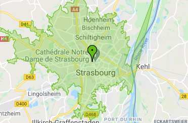
Paste it e.g. on geojson.io to see the geometry and properties listed in a table.
The area is in features[0].properties.area and has a value of 2202138.7 square meters

Best regards

how can i find iso distance ?

please read the documentation:
change the range_type to distance and adjust the range

Thank you…it worked

i want to purchase a plan…how can i do that as i dont find an option to buy

We don’t have business plans.
But you can write an email to :

can we make area even more sharper? like in screenshotScreenshot from 2020-12-24 12-21-21

You can set the smoothing factor to 0. It seems by default there is a higher value set.