# Routing issues (unable to set down shortest path)
**URL:** https://ask.openrouteservice.org/t/routing-issues-unable-to-set-down-shortest-path/511
**Category:** openrouteservice
**Created:** [May 8, 2019, 10:19pm UTC](https://ask.openrouteservice.org/t/routing-issues-unable-to-set-down-shortest-path/511 "2019-05-08T22:19:25Z")
**Posts on this page:** 2
**Page:** 1
### Author:  [@BthereDthat](https://ask.openrouteservice.org/u/BthereDthat)
#### Post date: [May 8, 2019, 10:19pm UTC](https://ask.openrouteservice.org/t/routing-issues-unable-to-set-down-shortest-path/511/1 "2019-05-08T22:19:28Z")
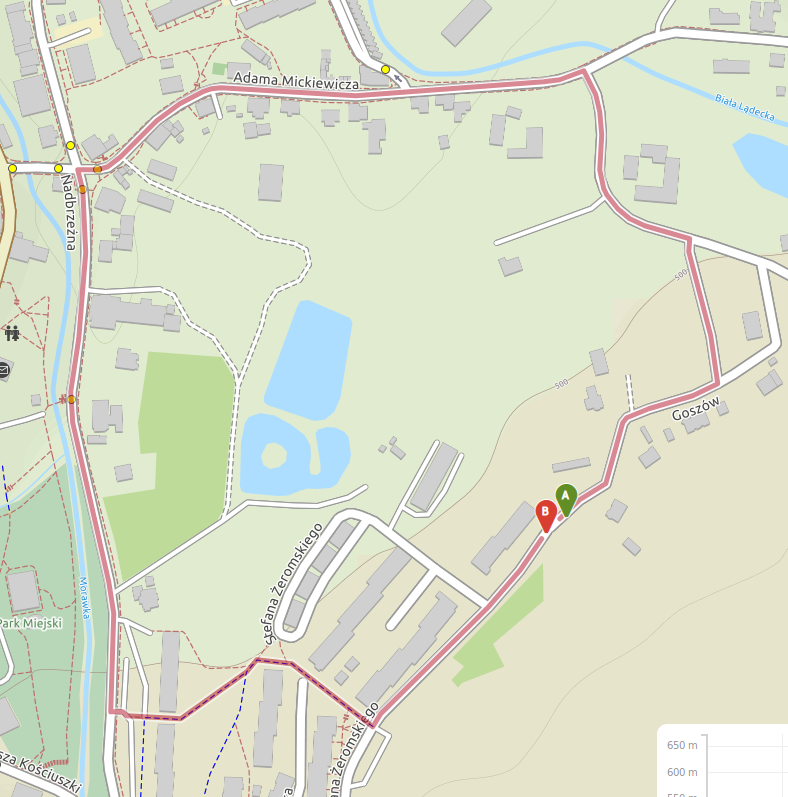
I have found two routing issues:
> **[Openrouteservice Maps](https://classic-maps.openrouteservice.org/directions?n1=50.293918&n2=16.878138&n3=17&a=50.293048,16.879978,50.292938,16.879764&b=1a&c=0&k1=en-US&k2=km)**
>
> Openrouteservice is a open source route planner with plenty of features for car, heavy vehicles, hiking and cycling.
> **[Openrouteservice Maps](https://classic-maps.openrouteservice.org/directions?n1=50.248481&n2=16.815546&n3=17&a=50.248069,16.814318,50.247877,16.814049&b=1a&c=0&k1=en-US&k2=km)**
>
> Openrouteservice is a open source route planner with plenty of features for car, heavy vehicles, hiking and cycling.
Routing is unable to set down direct/shortest path (straight line) between two points…
I can’t upload second screen-shoot - new user…
---
### Author:  [@andrzej](https://ask.openrouteservice.org/u/andrzej)
#### Post date: [May 9, 2019, 8:50am UTC](https://ask.openrouteservice.org/t/routing-issues-unable-to-set-down-shortest-path/511/2 "2019-05-09T08:50:59Z")
Thank you for reaching out!
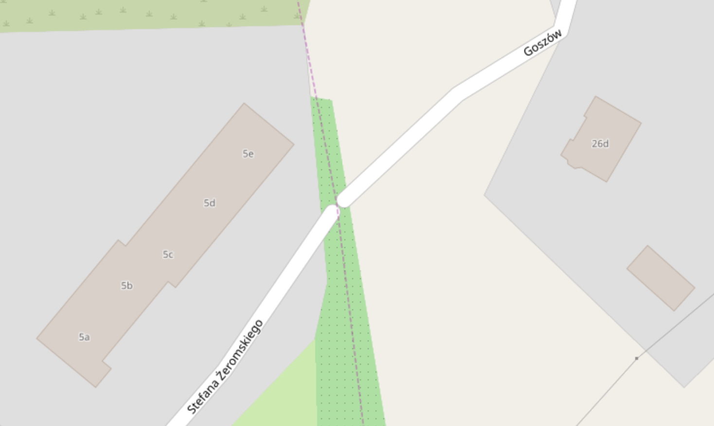
The first issue is caused by the fact that the road is not continuous which becomes evident at higher zoom levels on [openstreetmap](https://www.openstreetmap.org/#map=19/50.29305/16.87963&layers=N). If this is a data problem and in reality the two streets are actually connected then feel free to update the geometry on openstreetmap.
The second issue is caused by [the short track section](https://www.openstreetmap.org/way/358698625) which does not have any `tracktype` grade tag assigned and therefore is not considered for routing with regular bike profile. However, you can get a [direct route](https://maps.openrouteservice.org/directions?n1=50.24798&n2=16.814167&n3=17&a=50.248069,16.814318,50.247877,16.814049&b=1b&c=0&k1=en-US&k2=km) once you switch to the mountain bike profile.
Cheers,
Andrzej