This thread doesn’t make too much sense now because I answered the main part to my own question …
However, I have stumbled across some new evidence which I can’t explain; worthy of its own thread maybe?
- From: 117.871796 -32.337402
- To: 118.1875 -32.15744
The route calculated by ORS follows …

The route calculated by Google Maps follows …
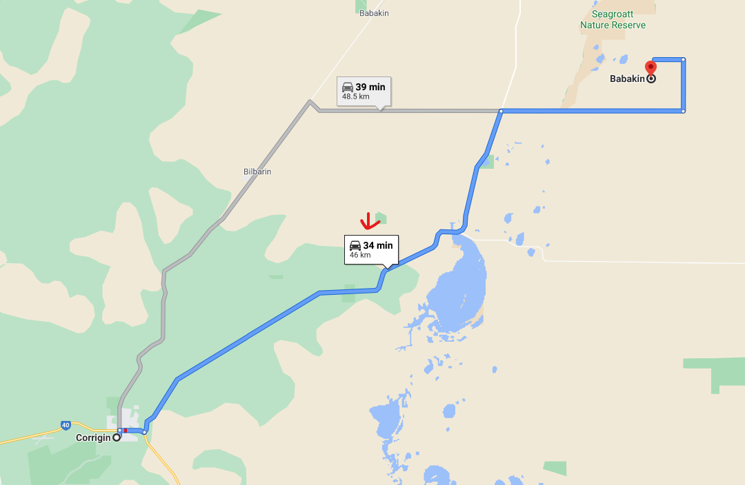
As you can see, the routes are pretty much exactly the same, but Google Maps has the distance = 46km and the duration = 34 mins … Compare this to the results from ORS and we see something interesting …
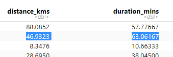
ORS matches the distance, as we’d expect, but the duration is waaaay off - just under twice the amount of time across the exact same route?
Investigating further, I looked on OverpassTurbo, recycling a query I found on the forum, to try and find what the issue was … I thought maybe the maxspeed had been input incorrectly, and that’s what was blowing out the duration estimate? However …
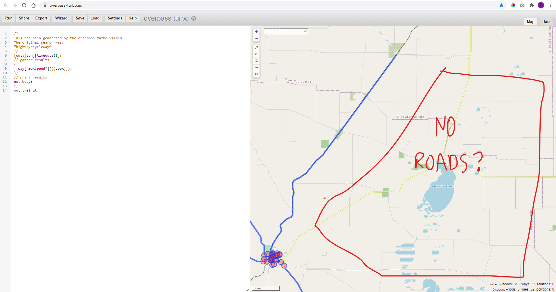
Overpass Turbo shows absolutely no roads on the map at all?? So, now I’m seriously confused how a route could’ve even been calculated along roads which don’t exist in ORS?
Granted this .pbf I’m using was subset from geofabrik Australia a couple months back - but I doubt someone would have deleted a clear main road since that point?
Any ideas what’s going on here? I’m happy to start another thread if necessary?
Cheers,
Troy