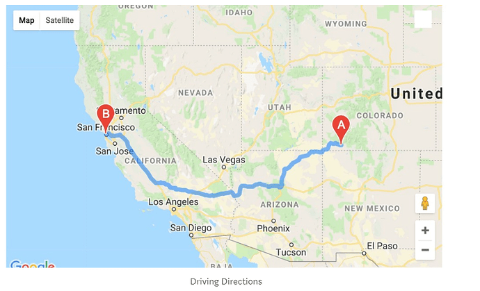
I need to draw car/driving route between two cities like in the picture . I got lattitude and longtitude of 2 cities. I need to draw path . Can openrouteservice do this with python code language ? Im new here so I will glad If anyone give me advice.
Im sorry ı forgot to mention about coding. I need to do this with python language.
thanks . I hope It can do what I want.
Update : It’s really hard to do what I what with openrouteservice I couldnt find any useful thing. I wish there is good&easy documentation/tutorial about openrouteservice and some examples about routes/draw plots.
In gmaps I can do what I want with these lines
import gmaps
#configure api
gmaps.configure(api_key=api_key)
#Define location 1 and 2
Durango = (37.2753,-107.880067)
SF = (37.7749,-122.419416)
#Create the map
fig = gmaps.figure()
#create the layer
layer = gmaps.directions.Directions(Durango, SF,mode=‘car’)
#Add the layer
fig.add_layer(layer)
fig
But I dont want to use gmaps so Im here to search.
Did you read the README? That tells you how to use the library.
Did you read the API docs? https://openrouteservice.org/dev/#/api-docs/directions/get
It’s really all just there in the open. If you have a specific question, post it here. Otherwise you’ll have to invest some time to make it work. We can’t guess what you’re doing and especially not what you’re doing wrong.
Okay thanks again. I will try look after myself
